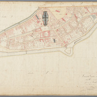
Cadastral map (original survey plan) Gouda, Section C, Sheet 01 (1811–1832)
Cadastral map 1811–1832: original survey plan of Gouda, South Holland, Section C, Sheet 01
geo:hasGeometry →
<n0dc657b9344c467989da57ed7c16f657b2>
|
geo:as |
LINESTRING see map — or expand"LINESTRING (4.7101317 52.0160275,4.7104786 52.0159857,4.7122337 52.0153039,4.7138278 52.0144446,4.7152414 52.0134994,4.7156401 52.0134864,4.7159324 52.0133703,4.71622 52.0131781,4.7159403 52.0126996,4.7154996 52.0124397,4.7162127 52.0082874,4.7160062 52.0074485,4.7138927 52.0075174,4.7133478 52.0079846,4.7127219 52.0087515,4.7123796 52.0092655,4.7119327 52.0101028,4.7108286 52.0108092,4.7104348 52.0108982,4.7105044 52.011612,4.710449 52.0135184,4.7103316 52.0148511,4.7101317 52.0160275)"^^geo:wktLiteral |
sdo:about →
Gouda
| sdo:name | "Gouda"@nl |
|
sdo:same |
Gouda (NL) |

