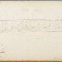
Kadastrale kaart (minuutplan) Gouda, sectie A, blad 01 (1811-1832)
Kadastrale kaart 1811-1832: minuutplan Gouda, Zuid Holland, sectie A, blad 01
sdo:associatedMedia →
<nfa704551f55d4e569fbb12149e3ae33fb2>


geo:hasGeometry →
<nfa704551f55d4e569fbb12149e3ae33fb1>
|
geo:as |
LINESTRING see map — or expand"LINESTRING (4.6997799 52.0117853,4.7036919 52.0144618,4.7043032 52.0146552,4.708898 52.0171126,4.7097131 52.0171817,4.7099651 52.0172032,4.7101317 52.0160275,4.7098519 52.0159452,4.7041802 52.0126862,4.7035229 52.0125551,4.7026828 52.0122929,4.7024022 52.0117992,4.7013064 52.0110425,4.7003902 52.0111637,4.6997799 52.0117853)"^^geo:wktLiteral |