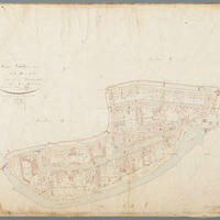
Kadastrale kaart (minuutplan) Gouda, sectie D, blad 01 (1811-1832)
Kadastrale kaart 1811-1832: minuutplan Gouda, Zuid Holland, sectie D, blad 01
geo:hasGeometry →
<n8110219c18f14bab9ecd39b75d1a3d01b1>
|
geo:as |
LINESTRING see map — or expand"LINESTRING (4.7035229 52.0125551,4.7041802 52.0126862,4.7046164 52.0124738,4.7062776 52.0114905,4.7071825 52.0107906,4.7083892 52.0101267,4.7090351 52.0100752,4.7098341 52.0104758,4.7104348 52.0108982,4.7108286 52.0108092,4.7119327 52.0101028,4.7123796 52.0092655,4.7127219 52.0087515,4.7133478 52.0079846,4.7138927 52.0075174,4.712561 52.0069817,4.7121552 52.0072768,4.7112773 52.0076101,4.7104025 52.0075929,4.71002 52.007639,4.7088417 52.0077808,4.7072028 52.0083218,4.7056023 52.0090746,4.7042095 52.009958,4.7036218 52.0105407,4.703582 52.0115019,4.7035229 52.0125551)"^^geo:wktLiteral |

